
Finer Details of the New M2 (Coomera Connector)
The M2 will better connect the Gold Coast. We're breaking down the location of each coridor to understand the impact as early as possible.
Introduction
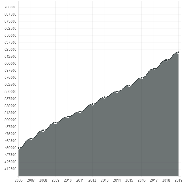
In the past years, we’ve seen extreme growth across the Gold Coast. Especially in the suburbs around Coomera and Pimpima. These suburbs have now outgrown their local infrastructure to the point that they are already under extreme pressure. Research data by the Gold Coast City Council found that the space of the M1 between Coomera and Oxenford to be the busiest point of the M1 today. In an aim to correct this the plans of a second highway that have long been on the cards for the Gold Coast are finally coming into action.
Primary Focus of the M2
Trying to understand what the short video and extremely pixelated proposed maps of the route are near impossible. The team at Ball Realty have taken the time to decipher this information and try to bring forward the key points that will matter the most to the Gold Coast population. We looked at each intersection point and worked with our team’s local expertise to raise the most important issues in each local suburb.
We’ve seen the start dates, funding and priority for this project go all over the place in the last few years. But as of September 2020, concrete plans finally are starting to take action. With the Queensland Government committing $755m to the project, followed by the start of consultation on Stage 1 in October.
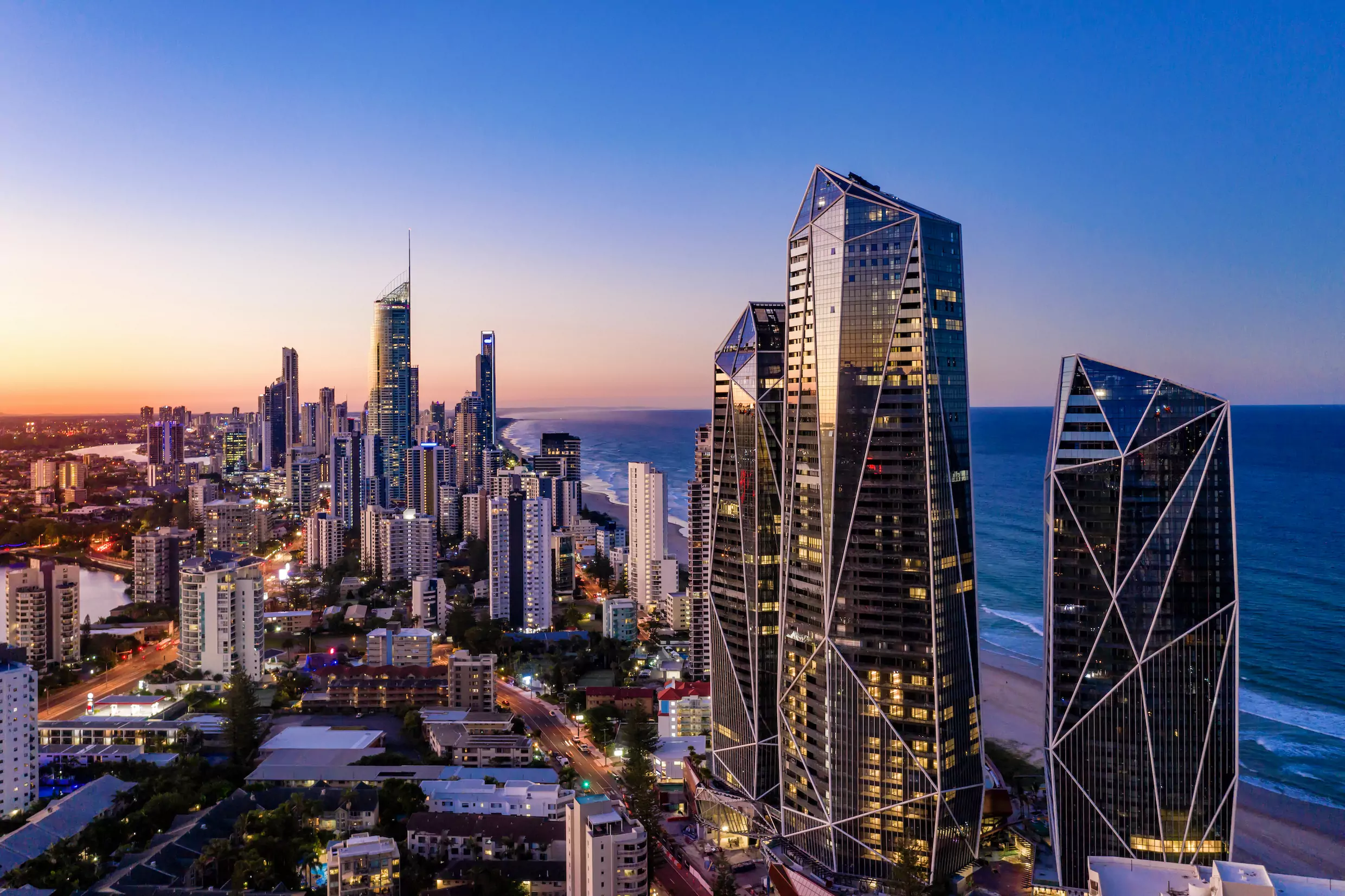
It’s worth also adding that my own family has been affected by the project long ago, almost 25 years earlier, when the project was under an earlier name. A relative of mine was forced to sell their property which lies where the M2 will cross Foxwell Road. This being a key piece of the puzzle to make this possible, it is unbelievable to think how long this plan has taken to begin, and how long the wheels have been in motion. From both this connection, living on the Gold Coast and Coomera Waters at times, I have spent plenty of time waiting and wondering how this will play out.
Gold Coast Population Growth.
Coomera Connector (M2) Stage 1:
Nerang to Coomera.
The Gold Coast City Council has copped some serious flack in the last year for their plans to run the southern section of the M2 so closely with the current M1. But if you’re honest with the situation, there was never a chance that council would be able to repossess and entire highway corridor through the highly developed suburbs of Bundall, Broadbeach Waters, Mermaid Waters.
These areas also have peaked development and have successfully planned better main roads and quieter streets on the Southern end of the Gold Coast. Whereas the ability to expand population numbers in Coomera, Pimpima and Jacobs Well is still very much able to grow.
A clear large decision-factor for the Coomera Connector is to increase accessibility for North Gold Coast residents for commuting south instead of the large preference of working in Brisbane. Running the M1 and M2 almost parallel in this area through Nerang will help keep entry/exit numbers lower, keeping travel times low in this particular stretch.
Carrara and Nerang.
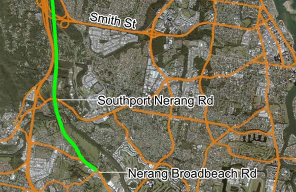
Starting South and moving North, the M2 Coomera Connector will begin from Nerang-Broadbeach Road, near Metricon Stadium. The highway will pass Nerang train station on the Eastern side, crossing the Nerang River to run parallel with the current M1 until passing Smith Street Highway. This section running alongside the current highway should act like a fast-moving section while the M1 can become congested here.
These central suburbs of the Gold Coast in the following years of the Coomera Connector could see the suburb become a hub for small and medium businesses. A large percentage of these new workers will be taken from Brisbane jobs, as availability for Southern Gold Coast jobs opens up.
Molendinar and Parkwood.
Passing Smith Street, the M2 continues parallel for another 5 km or so, until veering east to pass Westfield Helensvale on the right side, next to the train station. Running extremely close to one of the newer developments of the Gold Coast, The Surrounds. This section of land has been quickly developed as an open home village to try and sell plan homes as quickly as possible in the area. Although the area looks like a good investment this year, our team would advise strongly to wait until construction details are final and made clear.
One positive for the area is the current railway line runs on a lower section of land than The Surrounds. If this section is expanded to keep the noise of traffic contained, the area could end up being highly valued for its convenience. Work opportunity in the area will increase greatly with the increase in local industrial zoning.
Arundel.
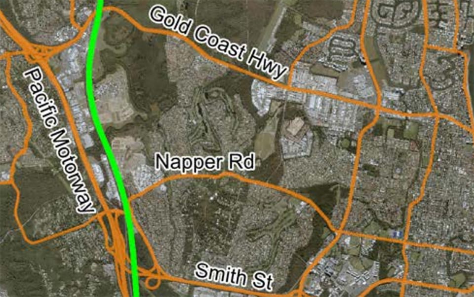
In Arundel, the parallel strip between both highways situated between Napper Road and the Gold Coast Highway will become one of the key industrial areas in the region. Connected greatly to existing industrial zones, we assume this region will grow and prosper quickly upon completion of the highway.
Anyone currently working in these industries, you will be able to clearly understand where your work will be located in 5-10 years time. The area will be able to employ people from as far North as Brisbane and South as Ballina. Making for a great place for a higher level of tech manufacturing industries not yet seen in the area.
Residents of Arundel should be keeping a close eye on final planned positions of the highway and make sure that they know straight away if it’s finalised too closely to their home. This section of the highway being so close to the existing M1, we believe it won’t improve home prices all that much in this locality.
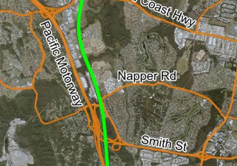
Helensvale.
As the Coomera Connector moves further north, entering Helensvale, it will swing out eastwards, running alongside the railway line, passing Helensvale Station and Westfield Helensvale. The highway is going to cut through the Careel reserve and pass Monterey Keys through the last strip of nature left in the suburb.
For this older locality of the Gold Coast, home prices are going to fall through the floor. Already suffering a lack of interest, the area is expected to lose more value once construction begins. One of the largest positives the area will gain from the new highway is much-needed congestion relief on the Gold Coast Highway and Helensvale Road, particularly the area between both highways, being the first few km’s of each M1 exit. Fixing the bank ups here will have a great effect on reducing commute times for everyone east of the M1
As the suburb has crept along slowly in terms of population growth in recent years. As this new highway reaches it’s final stages we are sure to see an increase in demand for the area again, with so much convenience to the Gold Coast already, it will be something to see when the M2 is finished. Providing more great opportunities for Gold Coast residents.
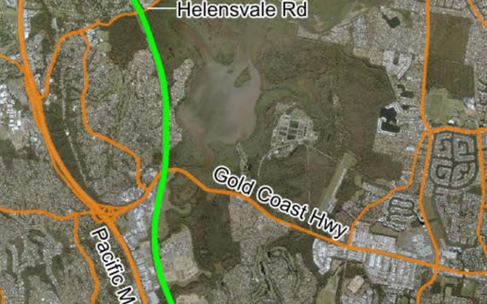
Hope Island and Monterey Keys.
One of the most interesting cases of the Coomera Connector was the task of deciding how the M2 would pass through the super-rich suburb of Hope Island. The main Hope Island Road is used by more traffic than it can currently handle. Feeding congestion up from Oxley Drive and down from Oxenford, this has been problematic for the area.
With crossing points for the highway and existing roads at the intersection of Monterey Keys Road and further north passing Hope Island Road. It will be interesting as details are finalised how these roads are joined with the highway. We will watch closely as these details are released and update the information here accordingly.
If they are not careful there will be a problem here at the entry and exits of the M2, most likely being an area where people cross the highway instead of getting on. Residents in areas such as Hope Shores and Sanctuary Cove will be delighted to see the M2 finally connect them with Coomera. After years and years of locals petitioning, this bridge will be sure to relieve a lot of traffic troubles.
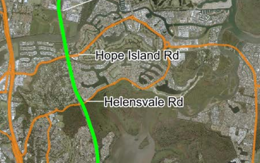
Coomera Connector (M2) Stage 2:
Coomera to Loganholme.
Coomera
Here’s where the highway begins to really get interesting. In Coomera, the new M2 will connect at the intersection of Beatie Road and the train line, then again further down at the intersection of Foxwell Road and Amity Road (Genesis Estate). At this point in time, the details of exactly how the M2 will pass through Coomera and all northern suburbs are still in the planning stage. We will update this blog as possible with the newest details available.
What we absolutely do know at this point is that after Beattie Road, as the M2 passes the Gold Coast Marina Precinct, it will begin to move away from running parallel with the current Gold Coast rail line. The M2 will verge east and cross. The M2 will cross the Coomera River and Oaky Creek, then passing through the expansive suburban locality, crossing at the point of Foxwell Road shown at the bottom right.
Coomera, especially Coomera Waters and Genisis will see a great possible rise in property value. Only if the construction of the M2 goes without destroying the natural beauty that has attracted residents in the first place. Looking at satellite imagery of the area, I don’t believe that will be possible.
With roughly only 25% of the original forest area left untouched around the suburbs of Coomera and Jacobs Well, it will be interesting to see what percentage has been managed to be kept by 2027 when Stage 1 (only) is expected to be finished). If you have property invested in these suburbs, again we would advise extreme caution heavily based around the Coomera Connector’s final design.
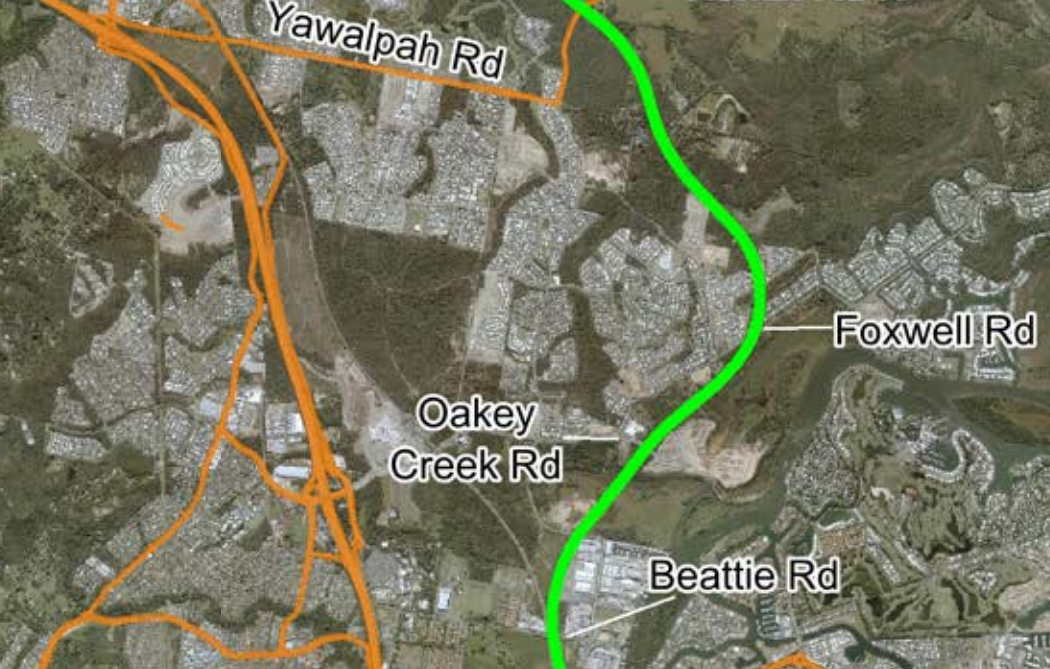
Pimpima and Jacobs Well.
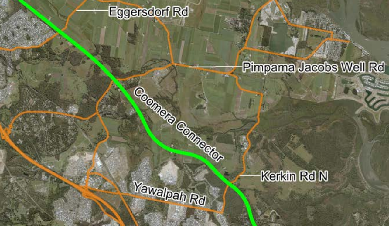
Right in the epicentre of the problem that the M2 plays to solve, the possible expanding population in this area over the coming years will be massive. As you can see in the images here, traffic entering and exiting these suburbs are only able to take 2 main roads as options, these are constantly bottlenecking already and the land left to build on here will be developed sooner than most think.
The rate of development out in this region is becoming almost dangerous, as infrastructure buckles the microeconomy could see are hard next few years. We advise taking caution when looking at investment properties in this area. Be sure to seriously look into the roads relied on and how they handle the current situation at all times of day, especially school times.
Ormeau.
Although Ormeau won’t directly see any new roads within the M2 upgrade, there will most definitely be secondary upgrades all around the area to better link the two major corridors. This will elevate great pressure on the area from a huge majority of traffic that is only passing through for very close suburbs. The plan of this highway linking with the M1 north of this point would divert much of the daily work commuters travelling to Brisbane from Coomera, to the M2.
As the area grows in the coming years, we are sure Ormeau will be presenting a completely different set of problems for local infrastructure than that addressed by the new highway. We believe there will be a massive diversion of traffic no longer passing through the area on the M1, whether this happens, in reality, is anyone guess.
What we do know for sure about the future of this area is the more and more than acreage and larger lots raise in demand, the more this area will prosper. As suburbia closes in, Ormeau has been a fresh reminder of the Gold Coast that once was.
Yatala.
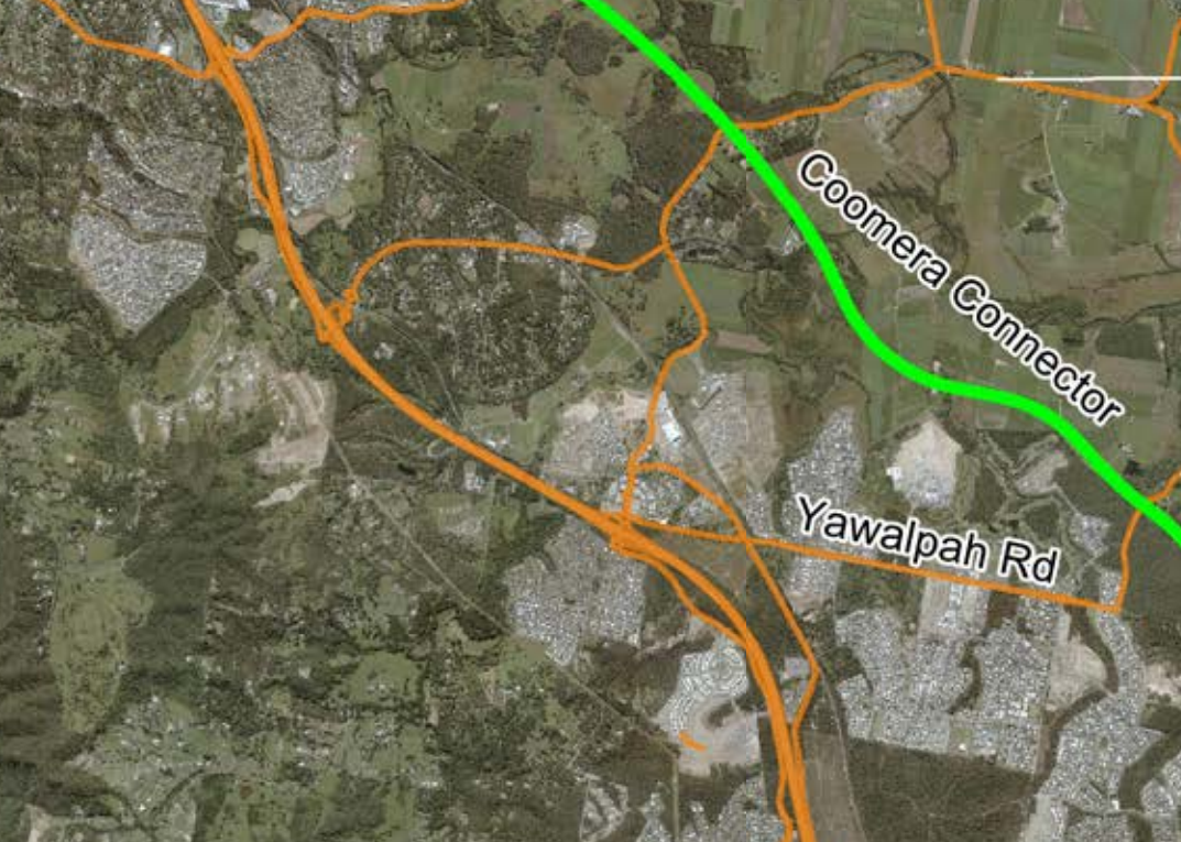
One of the fastest-growing suburbs on the Gold Coast this year, Yatala is now the epicentre of where Brisbane meets the Gold Coast, in terms of development. Speak to any tradesperson who works in SEQLD and see how much time they have spent in the last 5 years working in the development explosion centred between Ispwich, Brisbane and the Gold Coast.
For years, this section of the highway and even simple horse and carriage track in days gone, Yatala has only ever been a watering hole, stop-off point. Now as opportunity surrounds the area, and almost endless possibilities seem to lie on the horizon.
As development kicks off faster and faster each year, developing more elaborate and exquisite architecture each time over, there is a big shift in demand for less developed and built up suburbs. Whether it be to escape the traffic and bustle of suburbia, it seems that no matter where you go around here, it will follow shortly afterwards.
Stapylton.
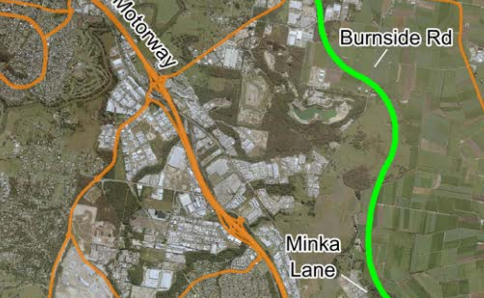
The suburb of Stapylton is more and more becoming the gateway to the last farmland left in south-east Queensland. Funnily enough, the next area of major land farming is found in the Scenic Rim. This area has long been left to suffer due to a lack of demand and opportunity, not for a lack of anything else. Position wise, you are in a great spot for commuting to Brisbane for office work in the city, the Gold Coast for even more job opportunity, as well as having access to all the labour work both East and West in all sorts of industries. In the coming 10 years. We can clearly see this will be a major point of construction and development, bringing government grants, more work, and more opportunity.
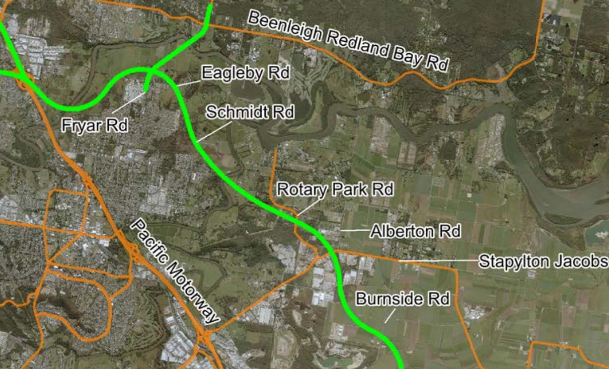
The road system in the area is well ahead of Yatala and Ormeau from the years of trucks coming through the area. But as the grid of farms is taken over by the even tighter grid of suburban homes, these roads will fail quickly. Afternoon traffic in the area is already at breaking point, so the sooner the main roads between the current M1 and expected M2 are improved, the sooner the area will see a proper increase in demand.
Right now if you are thinking of investing in these areas, our team of agents advise to take caution and do as much research as possible. Government plans are always hard to understand and clarity is hard to find. But locking into a 25+ year commitment takes understanding how the area will tolerate local populations for at least the next 50 years, if you are to see a great return on your investment.
Eagleby and Loganholme.
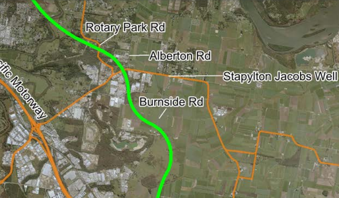
Eagleby and Loganholme are very much not a part of the Gold Coast at all, passing Yatala at this point may be the start of the Gold Coast officially. However once the M2 is finished and in place, it will be much harder to distinguish which city this area belongs too. These suburbs are going to significantly resemble the area around Eight Mile Plains and Rochedale. With major highways passing on either side and living on the junction, it could absolutely see a great positive change coming to the area.
Already a major suburb for industrial businesses and cheaper living, locating the junction at this point was a very smart move. As well as connecting with the M6 and continuing to Browns Plains and Ispwich, this will provide a great boost to the ability and convenience of this highway. We can see the area becoming a secondary hub for work away from central Brisbane and central Gold Coast, leading to a switch in the general percentage of commuters direction.
There are many points about the Coomera Connectors position and design that at first many people have questioned. But after narrowing in on the key areas affected, what their local needs are, and how the M2 looks to be dealing with them, I am extremely happy to see this highway be built as quickly as possible.
Contact Us
Sources:
TMR Queensland M2 Coomera Connector:
GHD Visualisation of Coomera Connector:
Video Assets of Visualisation of the M2 – Created by GHD Visualisation

Offices in Pacific Pines and Oxenford
07 5512 1337
Send us a message to tell us what you are looking for by filling out the form below. You can also attach images, pdf's or word documents .


